
Brookfield Neighbors by Official Source
A block search can describe land, civic geography, and voluntary community groups. It cannot produce a complete list of people. The Waukesha County Parcel Basemap shows parcels and their setting. Brookfield's interactive map adds owner and assessment popups. County NG911 records standard address parts and postal or emergency-service context. Election tools show wards and polling information, subject to voter privacy law. Association sites publish only what their groups choose to share.
| Source | What It Shows About a Block | Access |
|---|---|---|
| County Parcel Basemap | Parcel shapes, roads, facilities, landmarks, water, boundaries | Public viewer and REST layer; no occupants |
| City interactive map | Dated owner and assessment popup with map layers | Free web map; informational, not a legal survey |
| County NG911 | Address points, postal community, ZIP, ESN/MSAG and coordinates | Public service fields; not a resident roster |
| Election geography | Ward, district, polling place, notices and results | MyVote and clerks; protected voter fields withheld |
| Community associations | Public governance, meetings, common areas and group contacts | Voluntary and association-controlled |
An owner label identifies a person, trust, estate, company, or other party attached to the assessment record. The mailing address may differ from the parcel's site address. Neither field proves occupancy. Children, unregistered adults, people in protected programs, and many others will not appear in the public sources. Describe Brookfield neighbors as adjacent parcels or community contacts unless a person has chosen to publish a role.
Brookfield Neighbors Need Boundary Checks
A Brookfield postal label can refer to the City of Brookfield, the separately incorporated Town of Brookfield, or edge geography. County parcel data makes the distinction explicit: BRC is the city code and BKFT is the town code. Check that field before describing an adjacent parcel as part of the same municipal block.
The county NG911 layers add postal community, post code, emergency-service number, master street address guide community, and coordinates. Those fields help explain how an address is routed. They do not override the parcel's municipality. A ZIP, school district, ward, postal community, and city limit can draw different lines through the same area.
This geographic check is valuable near Elm Grove, City and Town edges, and planning corridors. It also keeps community group boundaries separate from government boundaries. An association may cover only a recorded development, while a City planning area may span many groups and properties.
Map a Brookfield Neighbors Block
The Waukesha County Property GIS is the main block-scale tool. Search one address, zoom until parcel outlines are clear, and click only the immediately adjacent shapes. Keep roads, water, facilities, and boundaries visible. They may explain why two parcels that look close are not part of one walkable block.
- Preserve the address as given, then separate its house number, street name, direction, type, and unit.
- Locate it in the county viewer and verify the municipality code. Use the map's identify action on parcels that share a line or corner.
- Record tax key, owner label, site address, mailing address, and source date. Call these owner records, not household records.
- Use the city map's select, measure, statistics, or attribute-table tools for a small geographic set. Avoid exporting a private-name block list.
- Switch to the full Brookfield street directory only when the task expands beyond the immediate block.
No official "people within a radius" search was found. A radius can be approximated with map measurement, but it remains a selection of parcels and map features. It should never be presented as a list of Brookfield neighbors or occupants.
Open the Waukesha County Parcel Basemap to inspect the public geographic layers.
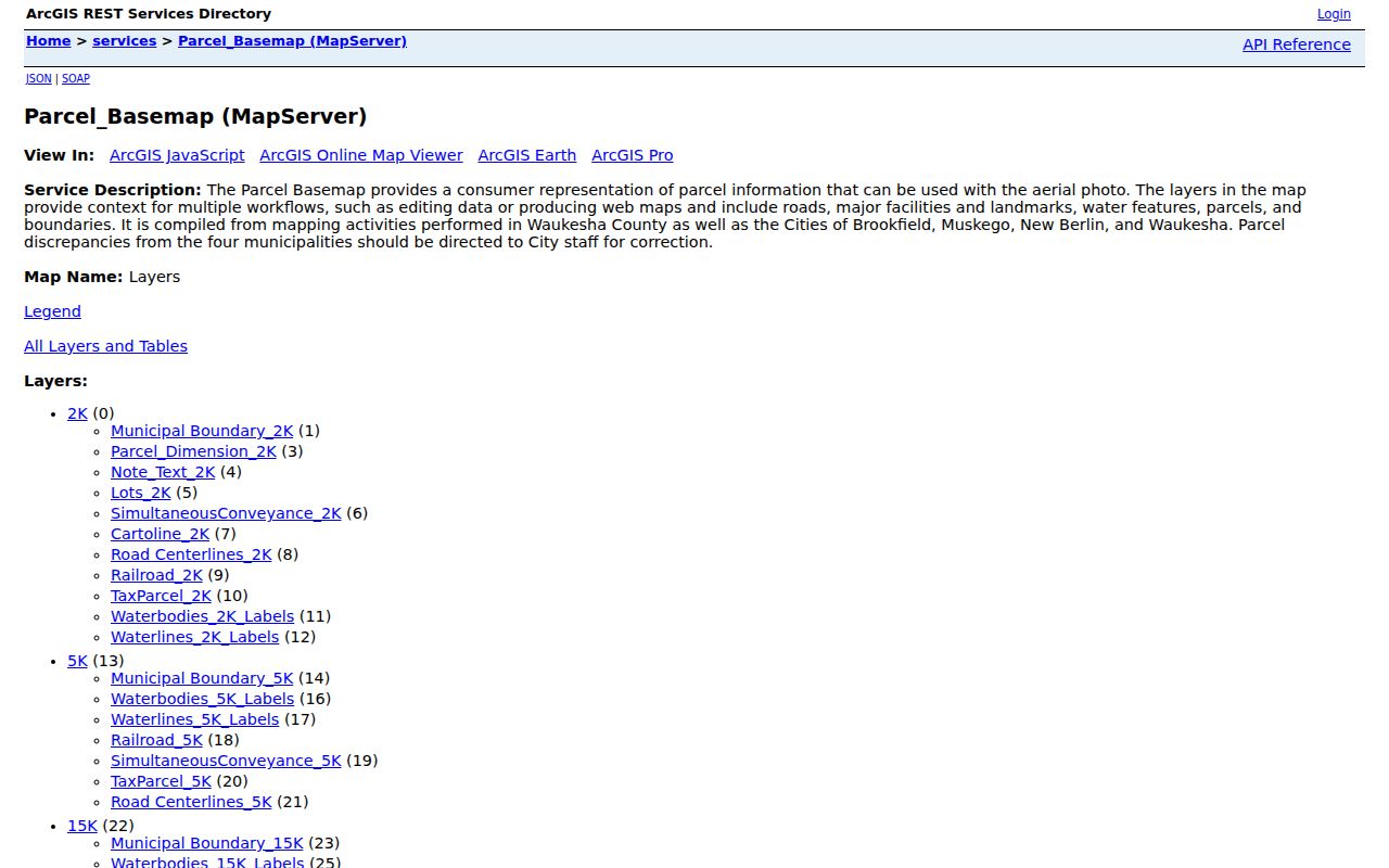
The captured service shows the local map context that makes a block search more accurate than a list based only on mailing ZIP.
Read Brookfield Block Context
The County Parcel Basemap combines parcels with roads, major facilities, landmarks, water, and government boundaries. Brookfield's map guide adds street, aerial, and topographic basemaps plus bookmarks for schools and parks. These layers answer practical questions about the block's physical setting without identifying private people.
Historic layers add another dimension. County services include annexations, retired plats, rights of way, and historic tax parcels reaching roughly to the mid-2000s. A 1965 Wisconsin Historical Society map supplies a street index, roads, schools, parks, cemeteries, and part of Elm Grove. Together, they can show why an old local reference does not line up with today's parcel grid.
Map geometry is dated and informational. County parcel boundaries reflect filed documents within a stated lag, and the City warns that its map is not a legal survey, engineering record, tax opinion, plat, or flood study. Confirm a disputed line through the original deed, survey, or public office.
Note: Treat a shared parcel edge as a map fact, not proof that the owners know one another or that either owner lives there.
Brookfield Neighbors in Associations
Community records are voluntary. Forest Walk Condominiums Owners Association publishes information about its elected board, meetings, minutes, financial reports, common property, and a Brookfield mailing address. Stonebrook HOA describes a 50-property association, common areas, and dues. Neither is a City-maintained resident list, and neither group's site should be used to infer membership for a parcel outside its stated boundary.
Forest Walk Association
Public governance and community material are controlled by the association. Confirm its boundary and member-directory policy directly.
Stonebrook HOA
The research identifies a 50-property association with common areas and dues. Public membership access was not established.
City Planning Areas
Brookfield plans name areas such as Civic Center/Ruby Isle, Moorland, Village Area, and Bishop's Woods, but publish no resident membership lists.
The City also identifies Calhoun/Capitol, Lilly/Capitol, Brookfield Square, 124th Street corridors, Northwest/South Gateway, and Brookfield Road/Capitol in planning work. Those names describe planning geography, not an association roster. No verified citywide umbrella group, block-watch directory, or congregation roster was located.
Review the Forest Walk public association site as an example of community-controlled information.
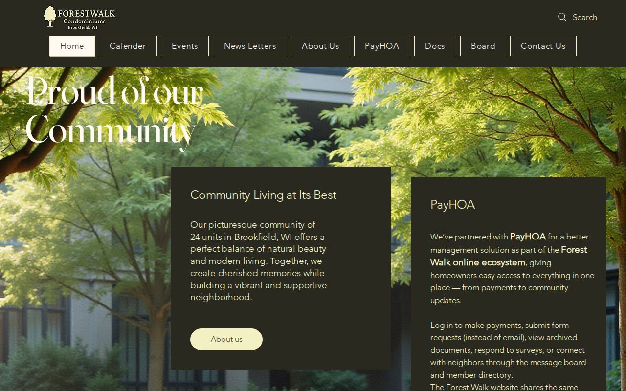
The screenshot illustrates the key distinction: association information comes from the group, not from a municipal resident database.
Brookfield Neighbors and Voter Data
Wisconsin MyVote supports a voter-facing address search with street, optional unit, city, and ZIP. Brookfield election pages provide wards, districts, polling places, notices, and results. This civic geography can describe which election district serves an address. It is not a public household census.
Wisconsin Statute §6.36 permits access to some nonprotected voter-list fields through defined routes, while birth dates, driver-license or Social Security information, confidential addresses, and accommodation fields remain protected. Renters, people who are not registered, children, and confidential-address participants may be missing. A registration can also be stale.
Use the official MyVote service for a person's own polling and registration task. Use City election maps for aggregate block context. Do not automate searches or publish a list of private names for nearby addresses.
Official Brookfield Neighbors Records
Commercial neighbor tools often combine property, voter, marketing, licensing, and other derived data. Their refresh dates, matches, payment rules, and correction routes vary. Official systems are narrower, but they identify the custodian and make their purpose easier to test.
| Source type | Useful strength | Main limit |
|---|---|---|
| Official parcel and assessment systems | Dated geography, tax key, owner label, legal description | Owner is not necessarily an occupant |
| Official election geography | Ward, district, polling and public notice context | Protected fields and incomplete household coverage |
| Voluntary association source | Board, meetings, common areas and chosen public contacts | Private membership and group-specific boundaries |
| Commercial compiled category | Broad hints from mixed sources | Unknown date, identity errors, paywalls and uneven removal |
For a permit, planning item, public works record, or City meeting record tied to one block, make a narrow open-records request. Brookfield accepts verbal or written requests by phone, mail, or electronic means. Name the department, address or project, record type, and date range. Ask for nonexempt portions if privacy rules require redaction.
Privacy for Brookfield Neighbors
Wisconsin Safe at Home protects an enrolled person's actual address by providing an assigned public-facing address. Voter records with confidential-address identifiers are also withheld. Utility customer records, delivery data, private phone numbers, email addresses, complete birth dates, and protected family details do not belong in a neighbor search.
A person can ask the responsible City, county, court, WEC, or other agency to correct its record through that keeper's process. The keeper may preserve an accurate historical record even when someone requests removal. Do not expose a replacement address while discussing a correction, and do not combine property names with sensitive court, health, or family information.
Lawful use. Research Brookfield neighbors only for lawful personal and civic purposes. Never use map or address data to stalk, harass, threaten, intimidate, or harm anyone.
Respect also improves accuracy. If an official parcel map shows only an owner label, report only that. If an association publishes a board contact, use it for association business. If a record is protected or absent, stop rather than trying to reconstruct a private household from unrelated files.